

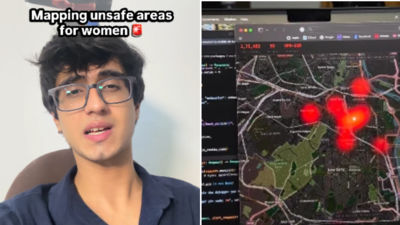
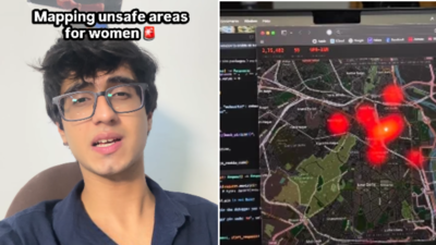
A 20-year-old college student has used publicly available crime data and artificial intelligence to map areas in Delhi where women may face higher safety risks. Raj Gomani, a third-year student at Manipal Institute of Technology (MIT) Mumbai, developed the map to identify potential crime hotspots and help authorities understand where security measures may need to be strengthened.According to a report by BW Policeworld, Gomani studied data from the National Crime Records Bureau (NCRB) and other publicly available platforms, examining reported crimes against women and the profiles of offenders to identify geographical clusters where such incidents appeared to be concentrated.The project also considers factors such as lighting, isolation and the availability of cameras, with the aim of making information about potentially vulnerable locations easier to understand.In a video about the project, Gomani said, “I mapped unsafe areas for women in Delhi with the profiles of the criminals in that area. I am disgusted that I even have to point out unsafe areas in our national capital.”The map, which he shared on social media, has brought attention to how publicly available data and AI tools can be used to examine urban safety concerns.
How Raj Gomani used AI to map potentially unsafe areas
Gomani told BW Policeworld that he used government data available online to study patterns of crimes against women in Delhi. He compiled the information into a dataset and examined offender profiles and geographical clusters to identify locations where reported crimes appeared to be concentrated.He also used Claude, an AI assistant, and other services while developing the map.Explaining what prompted him to work on the project, Gomani told BW Policeworld, “Delhi often faces the cases of sexual assault and rape, so I thought that a data driven map of unsafe places mapped together might help the local authorities and the government to come up with a women safety plan. Using Claude and other services, the map clearly helps in developing an insight on these places and if required the authorities can develop a stronger security set up in those areas to avert these cases”.According to The CSR Journal, the project is an attempt to turn extensive crime statistics into a more accessible visual resource. The map drew attention online after Gomani shared a video explaining its purpose and demonstrating the project.However, the map should be understood as a data-based attempt to identify potential risk patterns, rather than a definitive or real-time assessment of the safety of every location.
Delhi government invited him to present his research
The project also caught the attention of the Delhi government. According to BW Policeworld, Delhi chief minister Rekha Gupta and a team of IAS officers came across Gomani’s video on social media in July and invited him to present his research.Gomani told the publication that he presented his work to the chief minister and the team at her office. He said they told him that they would implement the idea in the city, but he had not seen any progress in that direction after the presentation.The development raises a broader question about how data-driven research by individuals can be translated into practical measures by public authorities.Gomani believes the map could help police forces examine vulnerable locations and identify gaps in existing security arrangements. He has also expressed a willingness to work with law enforcement agencies in other cities.“I would really want to take this up with a police force in any city who is willing to understand the hotspots in the city, the gaps and the lacuna where women safety is not foolproof. I would help them in any way possible from my end to develop such maps and aide in woman safety projects,” he told BW Policeworld.
Why mapping crime data is only one part of women’s safety
Gomani’s project attempts to make crime-related information more accessible by presenting it geographically instead of leaving it buried in extensive datasets. The approach could help authorities identify locations that merit closer examination and assess where security resources may be required.The CSR Journal reported that the initiative also prompted online discussions, with some users appreciating the effort to make crime data easier to understand and others suggesting that the project could be expanded or made open source.Yet identifying potentially unsafe locations is only one part of addressing women’s safety. A map can highlight patterns in reported incidents, but it cannot by itself prevent crime or guarantee that a particular area is safe.In his comments, Gomani argued that simply blaming governments or men would not resolve the issue. He emphasised collective responsibility and better allocation of resources to vulnerable locations.His work also points to a possible use of artificial intelligence beyond conventional applications: helping people make sense of publicly available information and presenting it in a format that may be more useful for decision-making.Gomani has also prepared similar data for Mumbai and regularly shares videos about his research into mapping data across different subjects on Instagram.For him, the larger objective is to help authorities understand where security arrangements may need attention. Whether the Delhi map is adopted for official use remains a separate question, but the project has brought a data-led approach to the discussion around women’s safety in urban spaces.